Citizens to Save the Allegheny Mountain Highway Visualizaton
I created this video for Citizens to Save the Allegheny Mountain (CTSAM) and the Pennsylvania chapter of the Sierra Club. This video accurately presents the damage a proposed highway cut would do to a landscape that is hundreds of millions of years in the making. And it presents CTSAM’s less destructive proposed tunnel alternative.
The video is in vertical format for the widest reach on social media, while the stills are horizontal to best present the landscape and the highway cut’s impact on it.
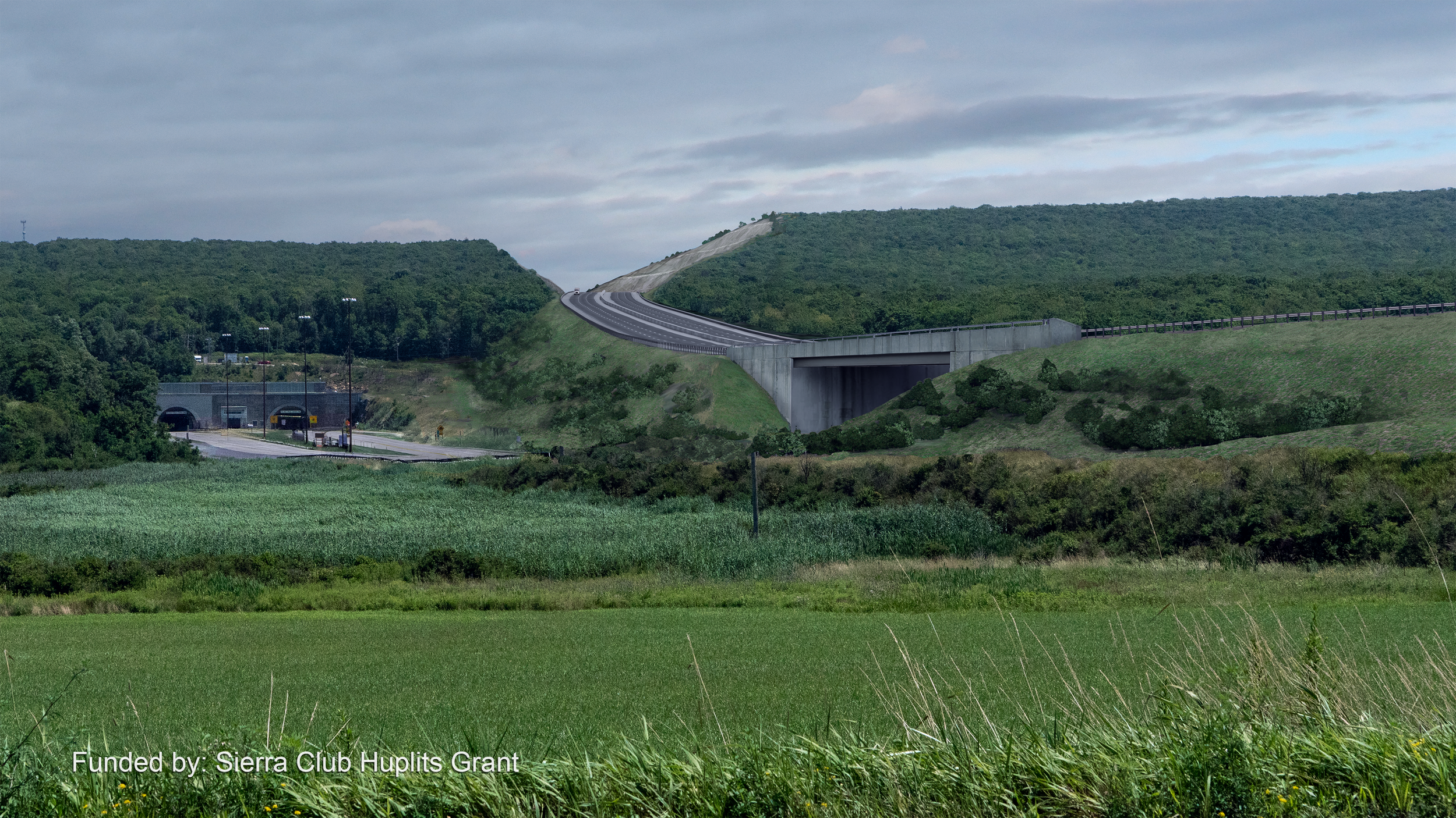
The source for the mountain model and the cut through it was GIS terrain I translated from a CAD file into a 3D model in 3ds Max, and then textured using a photogrammetry capture of the terrain.
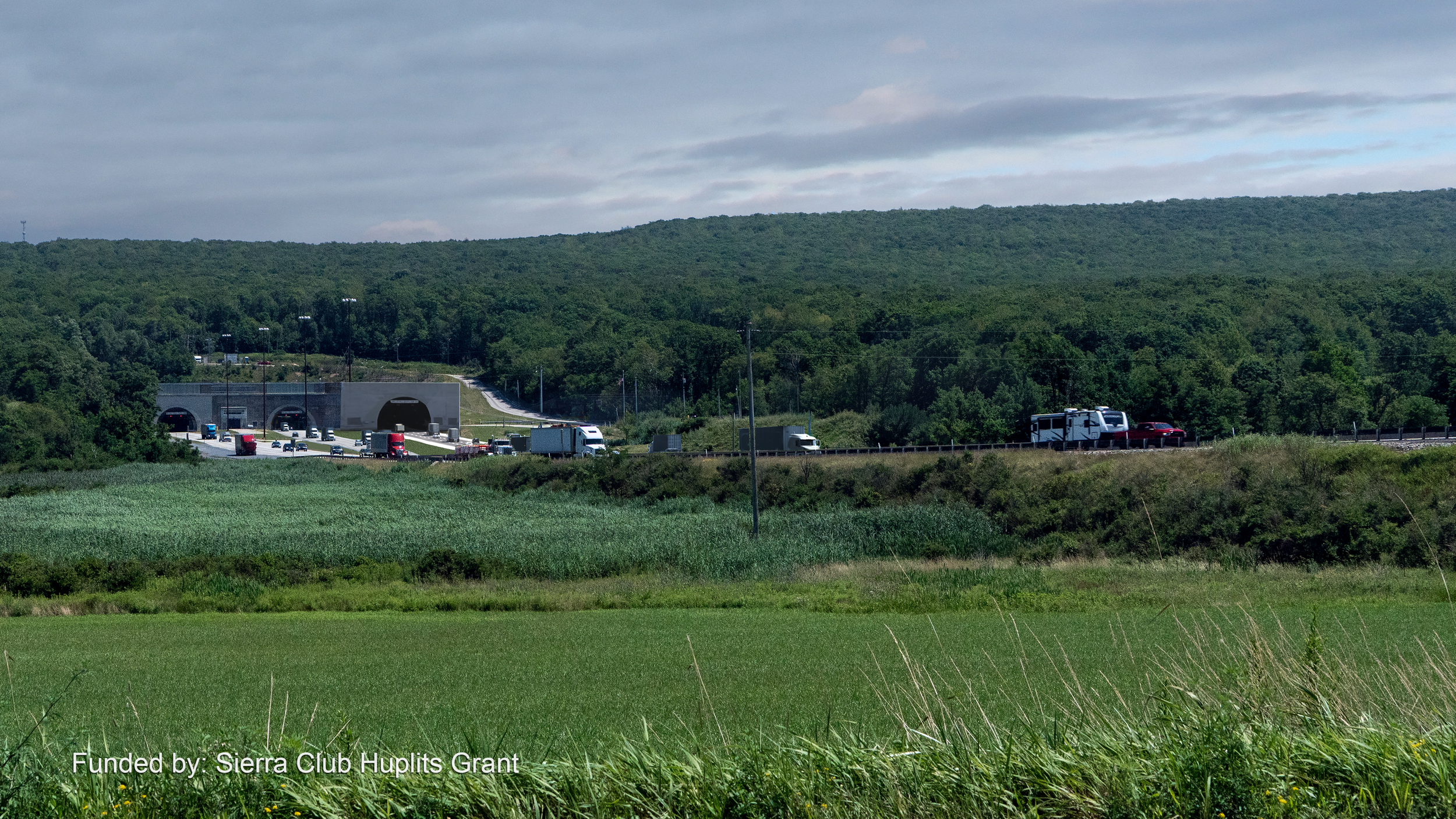
The current Allegheny Mountain from the east.
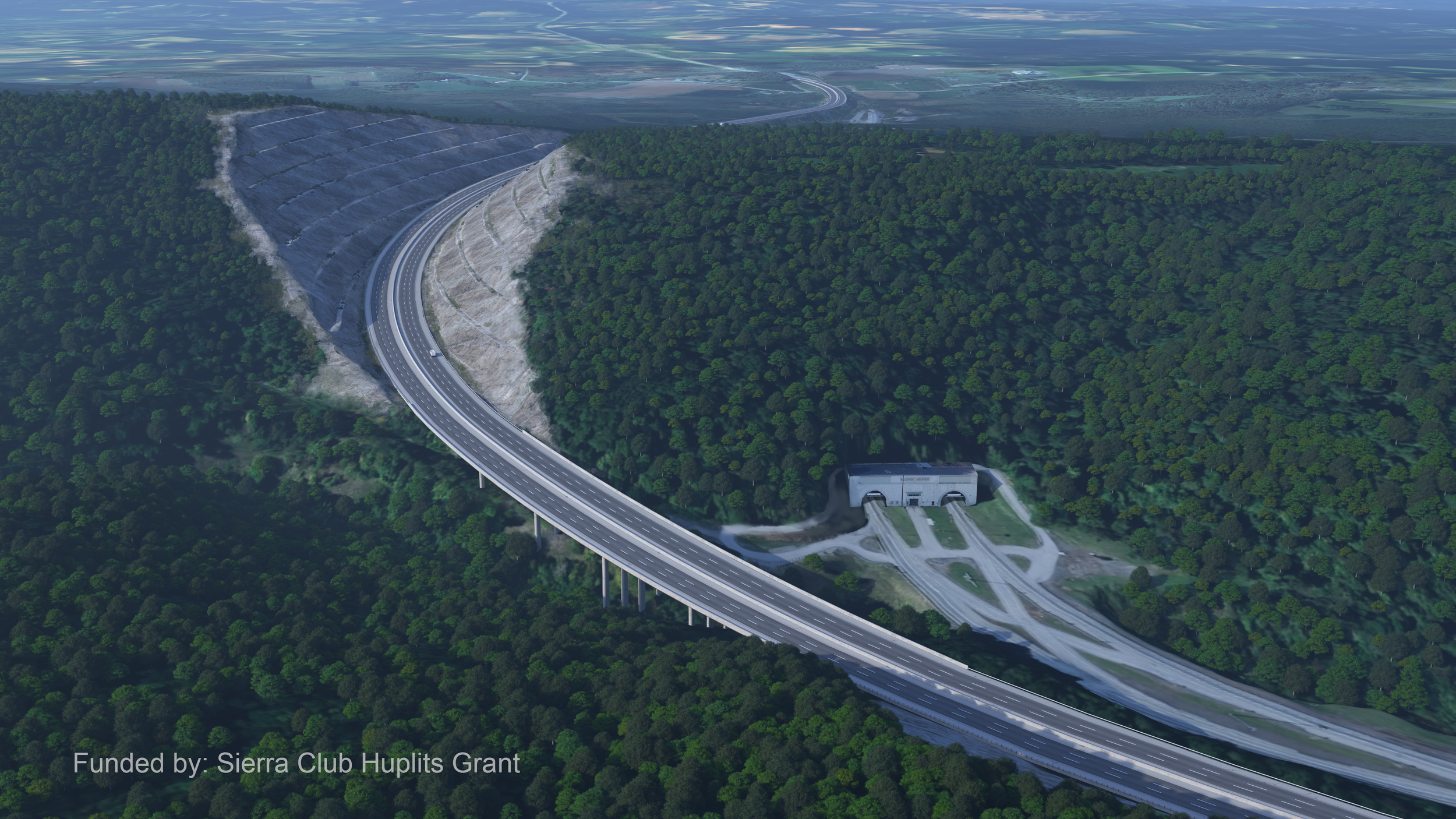
The proposed cut through the Allegheny Mountain.
CTSAM's proposed tunnel alternative.
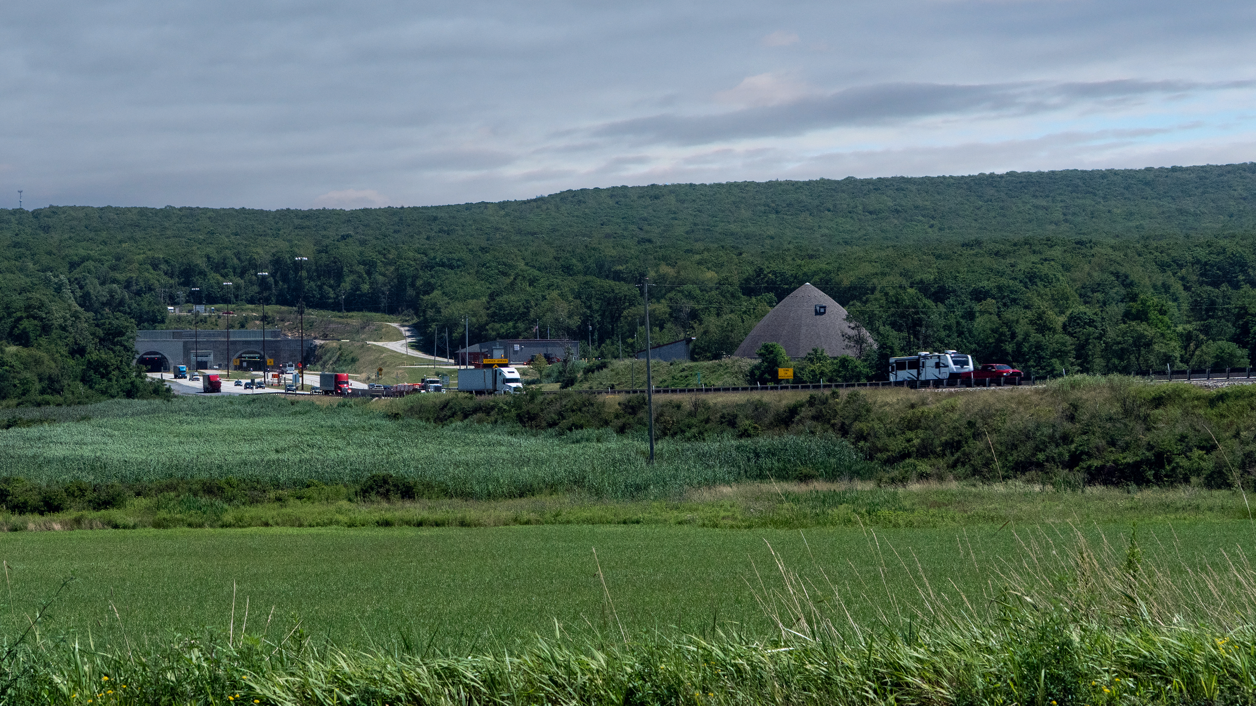
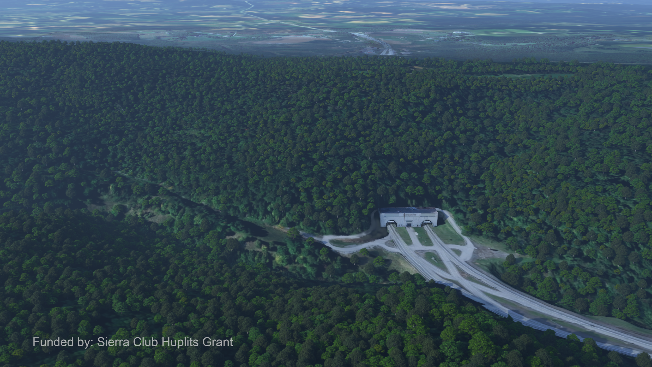
The current Allegheny Mountain from the west.
The proposed cut through the Allegheny Mountain.
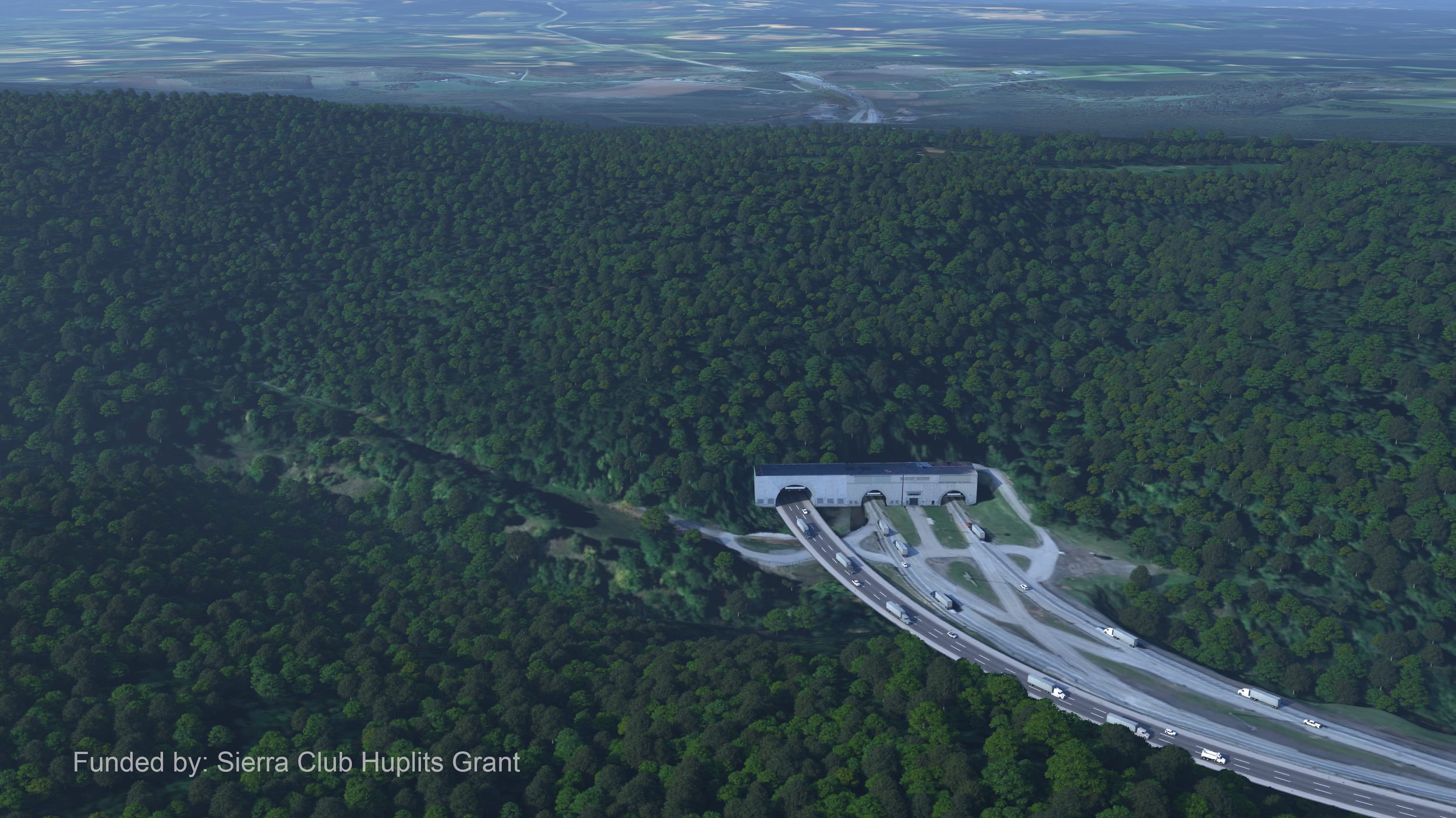
CTSAM's proposed tunnel alternative.